
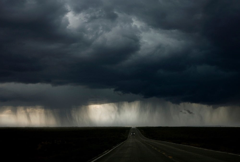
A storm surge and cold front are expected in at least two provinces, with very cold conditions persisting across the country. (John Lund/Getty Images)
A cold front and a storm surge are expected in at least two provinces, with the rest of the country set to experience disruptive rain, strong winds and morning frost, according to the South African Weather Service.
Impact-based warnings
– An Orange Level 6 warning for disruptive rain, resulting in the flooding of settlements, roads and bridges, some communities temporarily cut off as well as a danger to life, is expected in places along the coast and adjacent interior of the Eastern Cape in the morning.
– A Yellow Level 4 warning for a storm surge is expected in places along the coast between Plettenberg Bay and East London.
– A Yellow Level 2 warning for disruptive rain, resulting in localised flooding of roads and susceptible settlements as well as minor vehicle accidents due to slippery roads and reduced visibility, is expected over the south-western parts of the Western Cape and the southern parts of the Eastern Cape in the morning.
– A Yellow Level 2 warning for damaging winds, leading to difficulty in navigation at sea for small vessels and personal watercraft, is expected between Cape Point and Cape Agulhas and between Plettenberg Bay and Algoa Bay.
Advisories
Very cold conditions are expected over the interior of the Eastern Cape.
A cold front is expected over the Western Cape and the Northern Cape from Thursday, resulting in cold, wet and windy conditions in places over the Namakwa District of the Northern Cape and the western interior of the Western Cape.
ROLLING COVERAGE | 11 dead, dozens injured and at least 120 people displaced in aftermath of KZN floods
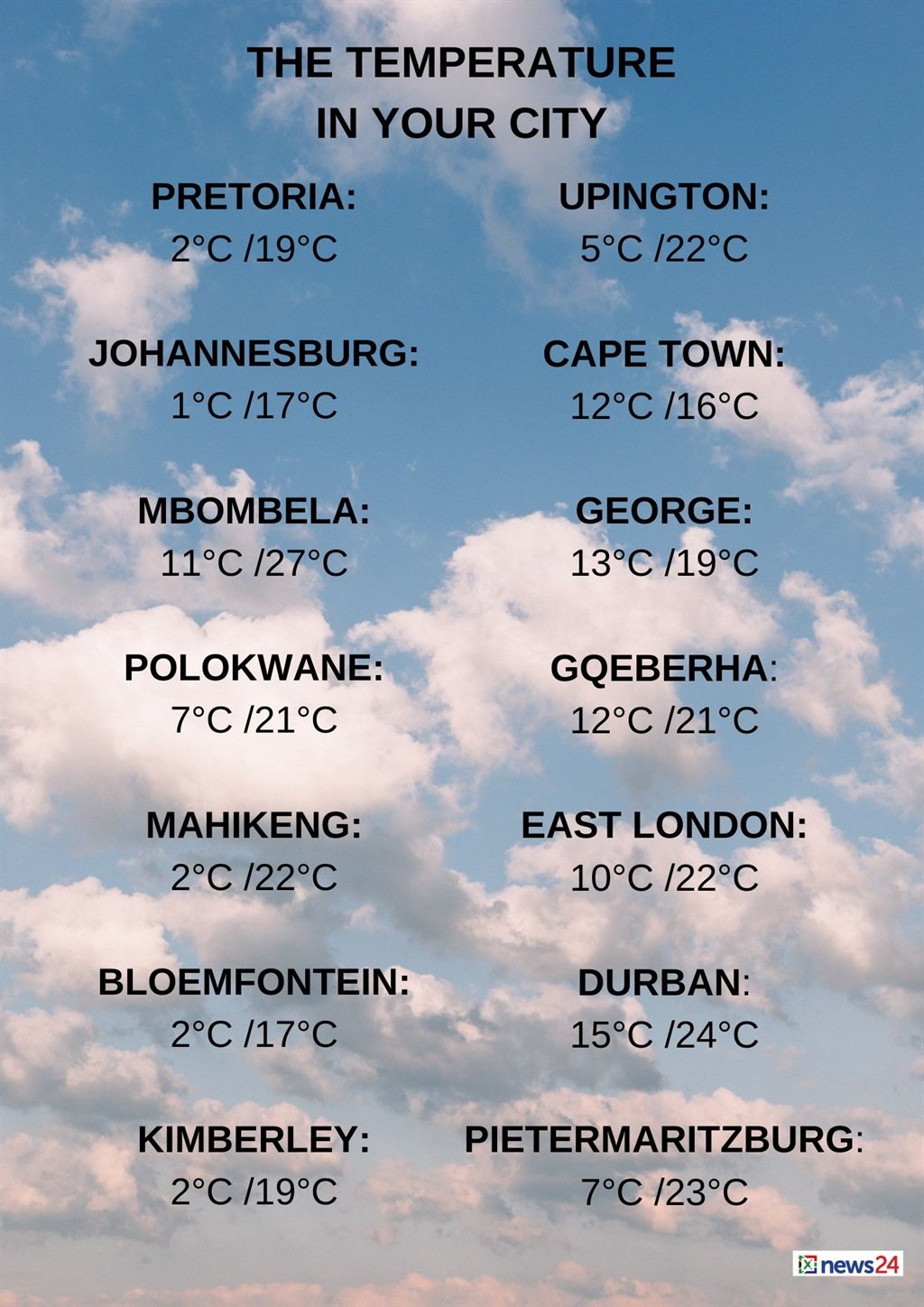
The weather in your region
Morning frost is expected in places in Gauteng, otherwise it will be fine and cool to cold.
The expected UVB sunburn index is high.
Mpumalanga will have morning frost in places on the Highveld, otherwise fine and cold to cool, but it will be warm in the Lowveld.
Morning frost is forecast in places in Limpopo’s south-west, otherwise it will be fine and cool to warm.
The North West will have morning frost in places, otherwise fine and cool conditions are expected.
Partly cloudy to cloudy conditions are expected in the Free State’s south at first, with morning fog patches in the east.
The Northern Cape can expect morning fog patches over the central and southern parts, otherwise fine and cool to cold temperatures are expected.
It will be partly cloudy to cloudy in the west and the south.
The wind along the coast will be a moderate to fresh northerly to north-westerly.
Cloudy and cold conditions are expected in the Western Cape, with isolated to scattered showers and rain in the west and south-west.
The wind along the coast will be a moderate to fresh north-westerly, but strong to near-gale in the south-west.
It will be a fresh westerly along the south coast, becoming strong in the afternoon.
The expected UVB sunburn index is low.
The western half of the Eastern Cape will be cloudy, windy and cold, with isolated morning showers and rain, but scattered in the south.
The wind along the coast will be a strong westerly, moderating in the evening.
Fine conditions are expected in the extreme eastern half of the province, otherwise it will be cloudy, windy and cold to very cold, with scattered morning showers and rain.
Th rain will be isolated in the north, where snowfalls are expected.
The wind along the coast will be a strong north-westerly, moderating along the Wild Coast in the afternoon.
KwaZulu-Natal will be fine and cool, but warm over the north-eastern parts.
The wind along the coast will be moderate north-westerly, becoming north-easterly from the afternoon.
The expected UVB sunburn index is high.


Recent Comments