
The South African Weather Service has issued a warning for extremely high fire danger in three provinces.
The South African Weather Service has advised of fire danger conditions in parts of the Northern Cape, Free State and Limpopo as a warning for thunderstorms in some provinces remains in place.
Impact-based warning:
A Yellow Level 2 warning for thunderstorms leading to gusty winds, small hail and heavy downpours is expected over the northern and western parts of KwaZulu-Natal, central and southern parts of Limpopo and in places over Mpumalanga.
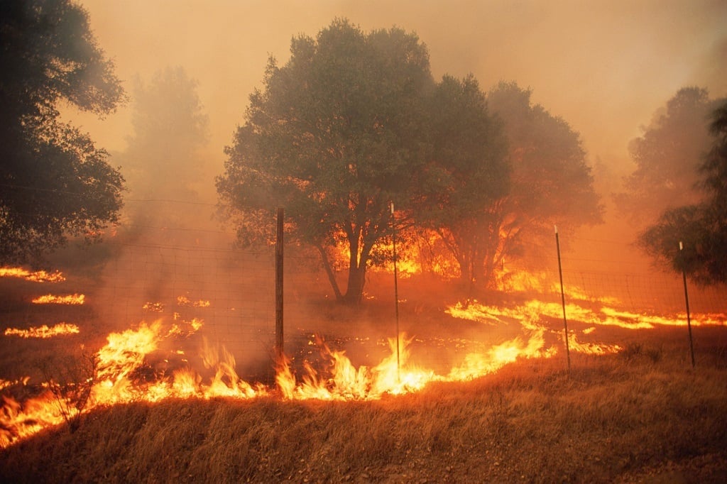
Fire danger warning:
Extremely high fire danger conditions are expected over the central parts of the Northern Cape, south-western parts of the Free State and the lowveld of Limpopo.
??Updated Heatwave Advisory: 28 November 2023??We expect today to be the last day of the heatwave conditions over most parts of the country, with just the northern parts of Limpopo remaining into tomorrow (Wednesday 29 Nov 23). pic.twitter.com/7vUxwalkdj
— SA Weather Service (@SAWeatherServic) November 28, 2023
Weather in your province:
Gauteng will be cloudy in the morning, otherwise partly cloudy and warm with scattered showers and thundershowers.
The expected UVB sunburn index is high.
It will be partly cloudy and warm to hot in Mpumalanga, with scattered showers and thundershowers.
Partly cloudy and warm conditions are expected in Limpopo, with scattered showers and thundershowers which will be isolated in the extreme north.
The North West will be partly cloudy, windy and hot with isolated showers and thundershowers but scattered over the north-eastern parts.
It will be partly cloudy, windy and cool to warm with isolated showers and thundershowers but scattered in the extreme eastern parts of the Free State.
Partly cloudy, windy and warm to hot conditions are forecast for the Northern Cape, with isolated morning showers and thundershowers in the east and north. It will be fine in the west and south.
The wind along the coast will be strong southerly to south-easterly.
It will be cloudy to partly cloudy in the east and along the south coast in the Western Cape at first with morning light rain along the south coast. It will be fine and cool to warm but hot in places over the interior of the West Coast District.
The wind along the coast will be strong south-easterly but light to moderate easterly to south-easterly along the south coast becoming fresh to strong in the afternoon.
The expected UVB sunburn index is extreme.
Partly cloudy and cool conditions are expected in the western half of the Eastern Cape, with isolated morning showers along the coast. It will become fine over the interior from late morning.
The wind along the coast will be moderate to fresh south-westerly, becoming moderate south-easterly in the afternoon.
It will be partly cloudy and cool with isolated showers and rain in places south of the escarpment in the eastern half of the province.
The wind along the coast will be moderate to fresh south-westerly, becoming moderate south-easterly in the afternoon.
KwaZulu-Natal can expect cloudy and cool conditions with isolated showers and thundershowers but scattered in the north and west. It will be warm in the north.
The wind along the coast will be fresh to strong southerly to south-westerly, reaching near gale in places in the morning.
The expected UVB sunburn index is moderate.


Recent Comments