
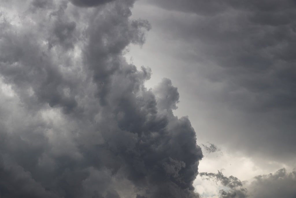
The South African Weather Service has warned of disruptive rain leading to localised flooding in some parts of the country.
Drew Angerer/Getty Images
The South African Weather Service has warned of disruptive rain leading to localised flooding in some parts of the country.
Impact-based warnings
A yellow level 2 warning has been issued for disruptive rain leading to localised flooding of susceptible settlements, roads, low-lying areas and bridges. Localised disruption to municipal services is also expected over the eastern half of the Eastern Cape, KwaZulu-Natal, highveld of Mpumalanga, Gauteng, western and central parts of Limpopo, eastern parts of the North West and north-east Free State.
Severe thunderstorms with strong, damaging winds and heavy downpours, leading to localised damage and flooding of roads, settlements (formal and informal), low-lying areas and bridges are expected over the extreme north-eastern parts of the Northern Cape and in places over the western parts of both the North West and Free State.
Damaging winds leading to disruption to beachfront activities and difficulty in navigation at sea are expected between Lambert’s Bay and Cape Agulhas.
Morning waves leading to small vessels such as personal watercraft taking on water in localities are expected between Cape Point and Port Nolloth.
Fire danger warning
Extremely high fire conditions are expected in places over Kamiesberg and Karoo Hoogland in the Northern Cape, as well as over the City of Cape Town, Matzikama, Cederberg and Beaufort West municipalities in the Western Cape.
Advisory
Very cold conditions are expected along the southern Drakensberg in the Eastern Cape.
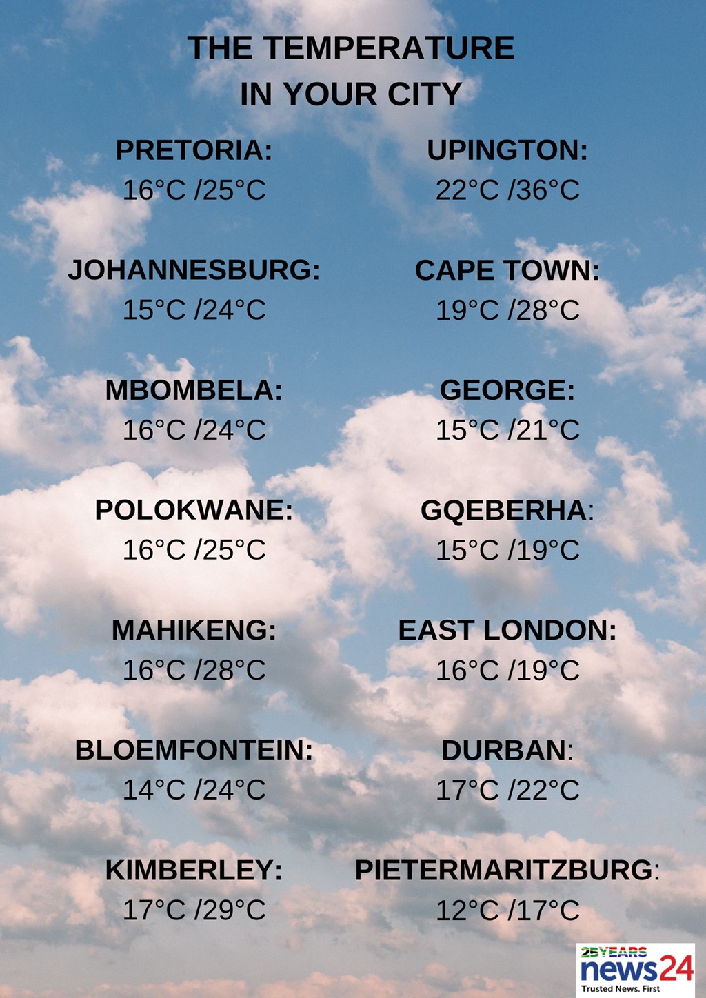
The weather in your province
Cloudy and cool to warm with morning fog patches and widespread showers and thundershowers are expected in Gauteng. The expected UVB sunburn index is low.
Mpumalanga will be cloudy and cool to warm with widespread showers and thundershowers scattered in the north-east.
Limpopo will also be cloudy and cool to warm with scattered showers and thundershowers widespread in the extreme south-west.
In the North West, it will be partly cloudy in the west at first, otherwise cloudy and cool to warm, with scattered to widespread showers and thundershowers, becoming windy in the evening.
Free State will be cold in the extreme east; otherwise cloudy, windy and cool to warm, with scattered to widespread showers and thundershowers.
It will be cool along the coast of the Northern Cape; otherwise partly cloudy, windy and warm to hot, with isolated showers and thundershowers in the east but scattered in the extreme east.
The wind along the coast will be fresh to strong south-easterly.
The Western Cape will be cloudy, windy and cool to warm in the east and along the south coast, but fine, windy and warm to hot in the west and south-west.
Light rain can be expected at times in the morning along the south coast and adjacent interior.
The wind along the coast will be a strong southerly reaching near gale to gale force along the south-west coast in the afternoon through to the evening. It will be a fresh to strong easterly to south-easterly along the south coast. The expected UVB sunburn index is extreme.
The western half of the Eastern Cape will be partly cloudy and cool, with morning rain in places south of the escarpment. The wind along the coast will be moderate south-easterly.
The eastern half of the province will be cloudy and cold, with scattered showers and rain. The wind along the coast will be moderate south-easterly.
KwaZulu-Natal will be cloudy and cool but cold in the south-west with widespread showers and thundershowers.
The wind along the coast will be moderate to fresh southerly to south-easterly. The expected UVB sunburn index is low.


Recent Comments