
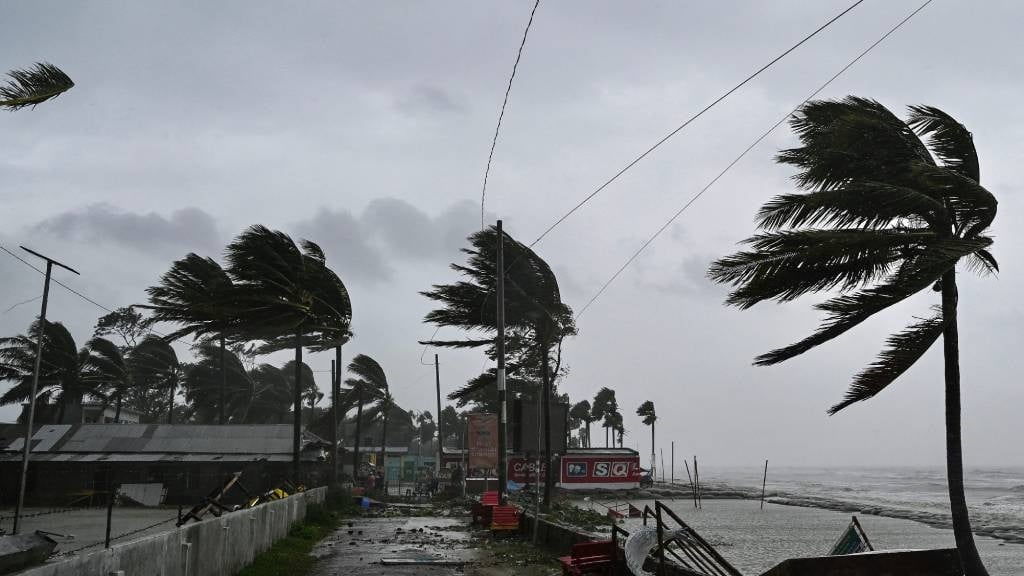
Severe thunderstorms and rains are expected in large parts of the country.
The South African Weather Service has warned of severe thunderstorms in a number of provinces across, with cloudy to cool and warm conditions expected elsewhere.
Impact-based warnings:
A. An Orange Level 5 warning has been issued for severe thunderstorms that will possibly bring heavy downpours and lead to flooding of roads, settlements, and low-lying areas. Large amounts of small hail and strong winds are also expected over the eastern parts of the Free State, the extreme south-eastern part of the North West, extreme southern parts of Mpumalanga and Gauteng Highveld, as well as the north-west parts of KwaZulu-Natal.
B. A Yellow Level 2 warning has been issued for severe thunderstorms with possible heavy downpours that could result in flooding in the northern parts of Gauteng, eastern and central parts of North West and Free State, extreme south-western parts of Limpopo and Mpumalanga Highveld, and the central and eastern parts of KwaZulu-Natal.
??Weather outlook for Tomorrow 7 November 2023.Showers and thundershowers over the central and eastern parts of the country, but widespread in places over the south-eastern parts of the country . Temperatures expected to drop over most parts of the country. #southafricanweather pic.twitter.com/xD898xL4DW
— SA Weather Service (@SAWeatherServic) November 6, 2023
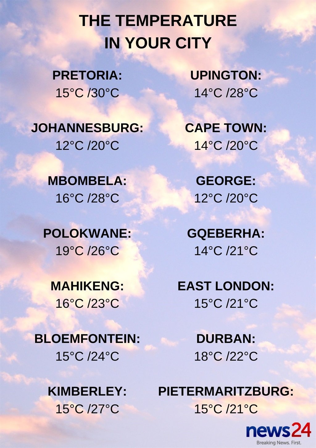
Weather in your province:
Gauteng will be cloudy and cool with scattered showers and thundershowers but widespread in the south.
The expected UVB sunburn index is high.
It will be cloudy and cool to warm in Mpumalanga with scattered showers and thundershowers but isolated in the north-eastern parts of the province.
Limpopo can expect cloudy and warm but hot conditions in places in the north. Isolated showers and thundershowers can be expected in the afternoon but scattered in the south-west.
It will be cloudy and cool to warm in the North West, with scattered showers and thundershowers, which will be widespread in the south-eastern parts of the province.
The Free State will be cloudy and cold to cool, with isolated to scattered showers and thundershowers, which will be widespread over the eastern parts.
It will be partly cloudy and cool to warm, with isolated showers and thundershowers in the extreme eastern parts of the Northern Cape, becoming fine over the central parts.
The wind along the coast will be fresh southerly, becoming strong by evening north of Port Nolloth.
It will be cloudy to partly cloudy and cool with a chance of light rain over the coastal areas of the Western Cape, as well as the adjacent interior, in the morning and will continue along the south coast into the afternoon.
The wind along the coast will be fresh to strong, westerly to south-westerly in the south, but light to moderate in the west and south-west, becoming fresh southerly in the afternoon.
The expected UVB sunburn index is high.
The western half of the Eastern Cape will be fine in the south-west at first, otherwise cloudy and cool with isolated showers and rain over the central and east.
The wind along the coast will be moderate to fresh south-westerly.
The eastern half of the province can expect cloudy and cool conditions, with isolated showers and thundershowers but scattered in the extreme east.
The wind along the coast will be moderate to fresh south-westerly.
KwaZulu-Natal will be cloudy and cool but warm in the north-east. Widespread showers and thundershowers are expected but will be scattered in the south and north.
The wind along the coast will be moderate to fresh north-easterly, becoming south-westerly from the south from mid-morning before spreading northwards.
The expected UVB sunburn index is low.


Recent Comments