
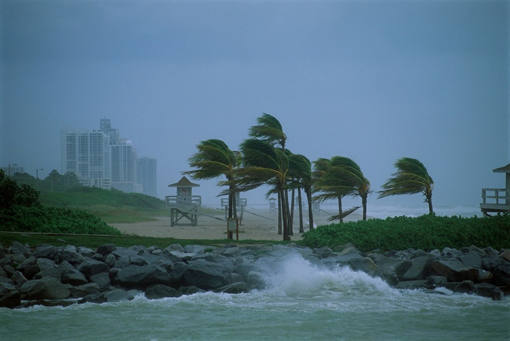
Damaging winds are expected in parts of KwaZulu-Natal and the Eastern Cape.
Warren Faidley/Getty Images
The South African Weather Service has issued impact-based warnings for damaging winds, resulting in difficult sea navigation, hazardous driving conditions and damage to property in parts of KwaZulu-Natal and the Eastern Cape.
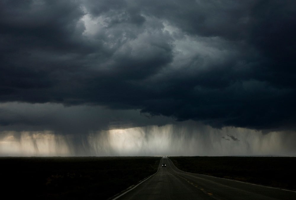
Other regions can expect partly cloudy conditions with cool to warm temperatures and isolated thundershowers, except in the east where hot to very hot temperatures are forecast.
Impact-based warnings
A Yellow level 2 warning for damaging winds, possibly resulting in difficulty in navigation at sea and small vessels taking on water and capsizing, was issued for the area between Durban and Kosi Bay.
Another Yellow Level 1 warning has been issued for damaging winds resulting in damage to property and difficult driving conditions in places in the Joe Gqabi District of the Eastern Cape.
Fire danger warning
Extremely high fire danger conditions are expected over the Beaufort West area in the Western Cape.
Advisories
Heatwave conditions resulting in persistently high temperatures over and above the average maximum are expected over the western and the central parts of the Free State, in most parts of the North West, as well as in the extreme north-eastern parts of the Eastern Cape until Thursday.
These conditions are also expected over Gauteng and the Mpumalanga Highveld, where they will persist until Saturday.
?????Weather outlook for Thursday, 15 February 2024:Partly cloudy and cool to warm with isolated to scattered showers and thundershowers over the eastern interior and southern parts. It will be hot to very hot in places in the east. pic.twitter.com/969BfK8skX
— SA Weather Service (@SAWeatherServic) February 14, 2024
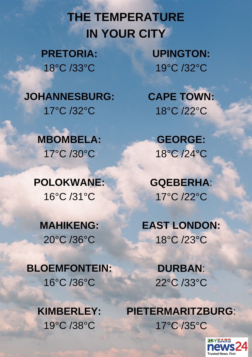
The weather in your region
Gauteng can expect partly cloudy and warm but hot conditions in places in the north, with isolated showers and thundershowers in the evening.
The expected UVB sunburn index is extreme.
Morning fog patches are forecast over the escarpment and southern Highveld in Mpumalanga.
Otherwise, fine and warm to hot but very hot temperatures are expected in the Lowveld.
It will become partly cloudy with isolated showers and thundershowers in the extreme south-east of the province by the afternoon.
Limpopo will be fine with hot to very hot conditions, becoming partly cloudy by the afternoon.
Fine and hot to very hot temperatures are expected in the North West and the Free State, becoming partly cloudy with wind, isolated showers and thundershowers over the central and the eastern parts in the afternoon.
The Northern Cape is expected to be fine but windy in places over the interior.
It will be hot to very hot, but extremely hot over the east.
The wind along the coast will be a moderate to fresh south-easterly at first, becoming a strong southerly to south-westerly from the afternoon.
Cloudy conditions are expected along the south coast of the Western Cape.
Otherwise, it will be partly cloudy with cool to warm temperatures and isolated showers and rain, scattered in the south-west.
The wind along the coast will be a moderate to fresh south-westerly.
The expected UVB sunburn index is very high.
The western half of the Eastern Cape can expect partly cloudy and cool to warm conditions.
Hot temperatures and windy conditions are forecast in places in the north with isolated showers and rain, but scattered in places along the coast where it will be cloudy.
The wind along the coast will be a moderate to fresh south-westerly, but strong at times.
Cloudy conditions with morning drizzle are expected in the eastern half of the province in places south of escarpment.
Otherwise, partly cloudy, windy and warm conditions are forecast with hot temperatures in the north.
Isolated showers and thundershowers are expected in the afternoon, but will be scattered along the Wild Coast and adjacent interior.
The wind along the coast will be a moderate to fresh south-westerly.
Morning fog is forecast in places over the interior for KwaZulu-Natal.
Otherwise, it is expected to be fine and hot to very hot, becoming partly cloudy with isolated showers and thundershowers, except in the north-east.
The wind along the coast will be a fresh to strong northerly to north-easterly, reaching near gale force in the afternoon.
It will become a moderate to fresh south-westerly south of Durban in the evening, spreading northwards.
The expected UVB sunburn index is extreme.


Recent Comments