
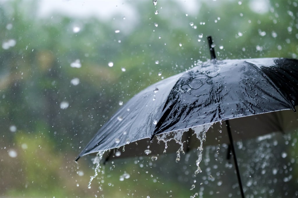
Severe thunderstorms with heavy downpours leading to localised flooding are expected for most of SA.
Sarayut Thaneerat/Getty Images
The South African Weather Service has warned of severe thunderstorms, heavy rain, damaging winds and hail in at least five provinces.
Impact-based warnings
A Yellow Level 2 warning for severe thunderstorms with possible heavy downpours, damaging winds and large amounts of small hail, leading to flooding of susceptible low-lying areas and bridges, disruption of high-sided vehicles, as well as disruption to services are expected in the western parts of KwaZulu-Natal, southern parts of Limpopo, extreme north-eastern parts of the North-West, extreme eastern parts of the Free State, as well as the central and northern parts of Gauteng.
Fire danger warnings
Extremely high fire danger conditions are expected over the Nama Khoi and Kamiesberg municipalities in the Northern Cape, as well as Laingsburg and the Breede Valley in the Western Cape.
Advisories
Extremely hot conditions are expected in the Nothern Cape’s Kamiesberg municipality, parts of Cape Winelands, Central and Little Karoo in the Western Cape, and Dr Beyers Naude municipality in the Eastern Cape.
A heatwave with persistently high temperatures is expected in the western parts of Chris Hani municipality, Dr Beyers Naude, Blue Crane Route, and Raymond Mhlaba municipalities in the Eastern Cape.
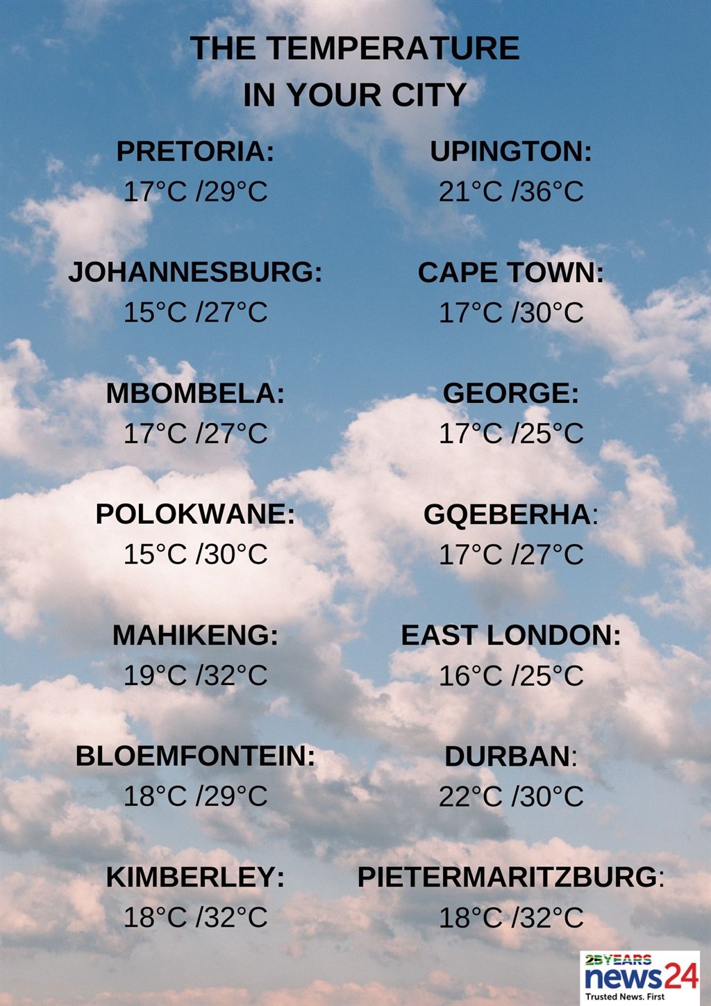
The weather in your region
Gauteng will be partly cloudy and warm with isolated afternoon showers and thundershowers, but scattered in the north where it will be hot.
The expected UVB sunburn index is very high.
Meanwhile, the City of Tshwane Emergency Services Department has called on residents to remain alert for possible disruptive rain, following the warning for severe thunderstorms.
The City urged residents to stay indoors and away from metal objects, to not seek shelter under trees or tall objects, avoid crossing flooded low-lying roads, bridges and swollen streams, and be aware that any combination of hail, strong winds, heavy rain and excessive lighting could accompany storms.
The lowveld in Mpumalanga will be hot, otherwise it will be partly cloudy and warm with isolated to scattered showers and thundershowers over the Highveld and escarpment.
Limpopo will be hot in the south-western Bushveld, otherwise partly cloudy and warm with isolated to scattered showers and thundershowers, except in the lowveld.
It will be partly cloudy and warm to hot with isolated showers and thundershowers in the North West, while the Free State will be partly cloudy and warm to hot with isolated showers and thundershowers, but scattered in the extreme east.
Northern Cape will see morning fog along the coast where it will be cool, otherwise partly cloudy and warm to hot, but very hot in places over the interior, with isolated showers and thundershowers, scattered in the extreme north.
The wind along the coast will be moderate southerly to south-westerly.
It will be cloudy with morning fog patches along the west coast of the Western Cape, otherwise partly cloudy and warm to hot, but very hot in places in the Little Karoo.
The wind along the coast will be moderate to fresh southerly to south-easterly, becoming fresh south-westerly along the west coast in the afternoon.
The expected UVB sunburn index is extreme.
The western half of the Eastern Cape will be fine and hot, but warm along the coast, becoming partly cloudy with isolated showers and thundershowers over the north-eastern interior.
The wind along the coast will be light south-easterly, becoming light to moderate easterly.
The eastern half of the province will be fine and hot, becoming partly cloudy with isolated afternoon showers and thundershowers.
The wind along the coast will be light to moderate south-westerly, becoming easterly by afternoon.
There will be morning fog over the interior of KwaZulu-Natal, otherwise partly cloudy and warm to hot, with isolated showers and thundershowers, except in the extreme north-east.
The wind along the coast will be moderate to fresh north-easterly becoming south-westerly in the south, spreading to Mandeni by the evening.
The expected UVB sunburn index is high.


Recent Comments