
The South African Weather Service issued severe warnings for multiple provinces, including the Eastern Cape, Western Cape, Northern Cape and KwaZulu-Natal.
Disruptive snow, which could result in icy roads and traffic disruptions, is expected over the northern high ground of the Eastern Cape, the southern high ground of the Northern Cape, and the Central Karoo of the Western Cape.
Flooding is expected in parts of the coastal provinces.
Impact-based warnings:
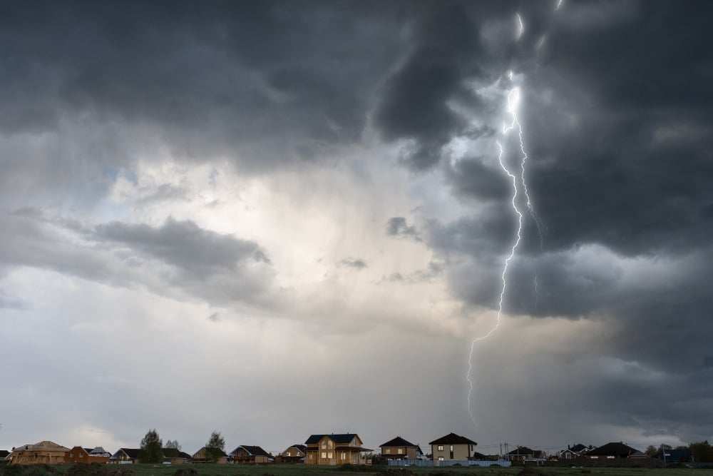
– A Yellow Level 4 warning for severe thunderstorms, resulting in large amounts of small hail and localised flooding of roads and settlements, is expected over the Central Karoo, Garden Route, Cape Winelands and the Overberg districts of the Western Cape, including the eastern parts of the West Coast in the evening.
– An Orange Level 6 warning for disruptive rain, resulting in flooding of settlements, roads and bridges, some communities temporarily cut off, as well as danger to life, is expected in places over the coast of the Eastern Cape and the adjacent interior.
– A Yellow Level 2 warning for severe thunderstorms, resulting in strong damaging winds and hail, is expected over the eastern parts of Free State, Gauteng, the north-western parts of KwaZulu-Natal, and the highveld of Mpumalanga.
– A Yellow Level 2 warning for disruptive rain, resulting in flooding of settlements, roads, low-lying areas and bridges, is expected in places south of the escarpment and the extreme northern parts of the Eastern Cape.
– A Yellow Level 4 warning for disruptive rain, resulting in flooding, is expected over the extreme southern coast of KwaZulu-Natal.
– An Orange Level 6 warning for disruptive snow, resulting in the loss of livestock and crops, as well as some communities being inaccessible, is expected over the north-eastern high ground of the Eastern Cape.
– A Yellow Level 2 warning for disruptive snow, resulting in icy roads and traffic disruptions, is expected over the northern high ground of the Eastern Cape.
– A Yellow Level 4 warning for disruptive snow, resulting in the loss of livestock and crops, as well as some passes being inaccessible, is expected over the southern high ground of the Northern Cape and the Central Karoo of the Western Cape.
– A Yellow Level 2 warning for damaging wind and waves, leading to localised disruptions to harbours and/or ports, difficult driving conditions along coastal routes/roads and choppy seas, as well as possible coastal infrastructure damage in exposed bays, are expected along the coast between Cape Point and Richards Bay.
Good Morning Weather enthusiastsPlease take note of the severe weather alerts issued for the upcoming days. Please adhere to the weather warnings and stay safe.Feel free to share with us the weather conditions that you are experiencing in your various regions.#EarlyWarnings pic.twitter.com/HVFrRitv88
— SA Weather Service (@SAWeatherServic) June 2, 2024
Advisories:
Very cold, wet and windy conditions, with snowfalls, are expected over the southern high-lying areas of the Namakwa District and southern high ground of the Northern Cape, the central and eastern interior of the Western Cape, the northern high ground of the Eastern Cape, and the central and southern parts of the Free State until Tuesday.
Weather in your region
Gauteng will be cool in the north, otherwise cloudy and cold, with isolated morning showers and thundershowers, becoming partly cloudy from the afternoon.
The expected UVB sunburn index is high.
Mpumalanga will be cloudy and cool to cold, with isolated showers and thundershowers, but scattered in the south-east, clearing from the west in the late afternoon.
It will be partly cloudy and cool to warm, but cloudy in the south-east of Limpopo in the morning, with isolated showers and rain, becoming fine from the west in the afternoon.
North West will be partly cloudy and cold to cool, with isolated showers and thundershowers, except over the extreme north-western parts.
Partly cloudy and cold conditions can be expected in the Free State, with scattered showers and thundershowers, but isolated in the west.
It will be partly cloudy in the north-east of the Northern Cape, otherwise cloudy and very cold to cold, with isolated to scattered showers and thundershowers.
The showers will be widespread in the south, where there will be snow during the course of the day.
General windy conditions are expected.
The wind along the coast will be moderate to fresh westerly to north-westerly.
Western Cape will be cloudy and cool to cold, with scattered to widespread showers and thundershowers, but isolated in the extreme north-west.
Snow in the mountain tops of the northern Central Karoo can also be expected.
There will also be general windy conditions.
The wind along the coast will be fresh to strong easterly east of Cape Agulhas until the late morning, otherwise fresh to strong north-westerly to westerly, reaching near-gale at times in the west and south-west coast.
The expected UVB sunburn index is low.
The western and eastern parts of Eastern Cape will be cloudy and cold, with scattered showers and thundershowers, but widespread along the Wild Coast.
The wind along the coast will be light to moderate north-easterly in the morning, becoming north-westerly by afternoon.
KwaZulu-Natal will be cloudy, with widespread showers and thundershowers.
The wind along the coast will be fresh to strong north-easterly, becoming very strong in places.
The expected UVB sunburn index is very high.


Recent Comments