
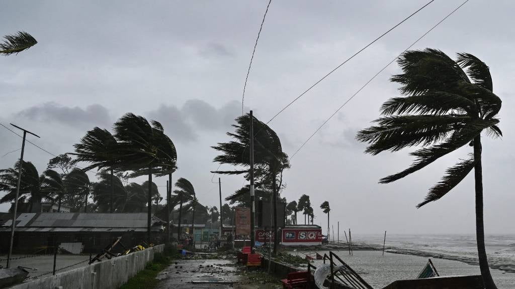
The weather service has warned of damaging wings in some parts of coastal provinces. (Munir Uz Zaman/AFP)
The South African Weather Service has warned of storm surges, damaging winds and waves, snowfall and very cold conditions in parts of the country’s coastal provinces.
Impact-based warnings
An Orange Level 5 Warning: Storm surge is expected along the coast between Plettenberg Bay and Buffalo City, resulting in coastal flooding due to an increased sea level of 0.4m above the highest astronomical high tide, combined with already flooding rivers.
A Yellow Level 2 Warning: Damaging winds and waves leading to difficulty in navigation at sea of small vessels and personal watercraft are expected between Plettenberg and Kosi Bay.
A Yellow level 2 warning: Damaging waves resulting in difficulty in navigation in small vessels taking on water along the coast between Plettenberg Bay and East London, spreading to Port Edward by Friday morning.
A yellow level 2 warning: Disruptive snow leading to icy roads and traffic disruption with some passes being closed for a short period over the north eastern parts of the Eastern Cape.
Advisories
Very cold, wet and windy conditions are expected over the southern parts of both Free State and Northern Cape, as well as the Karoo Hoogland and Beaufort West municipalities in the Western Cape.
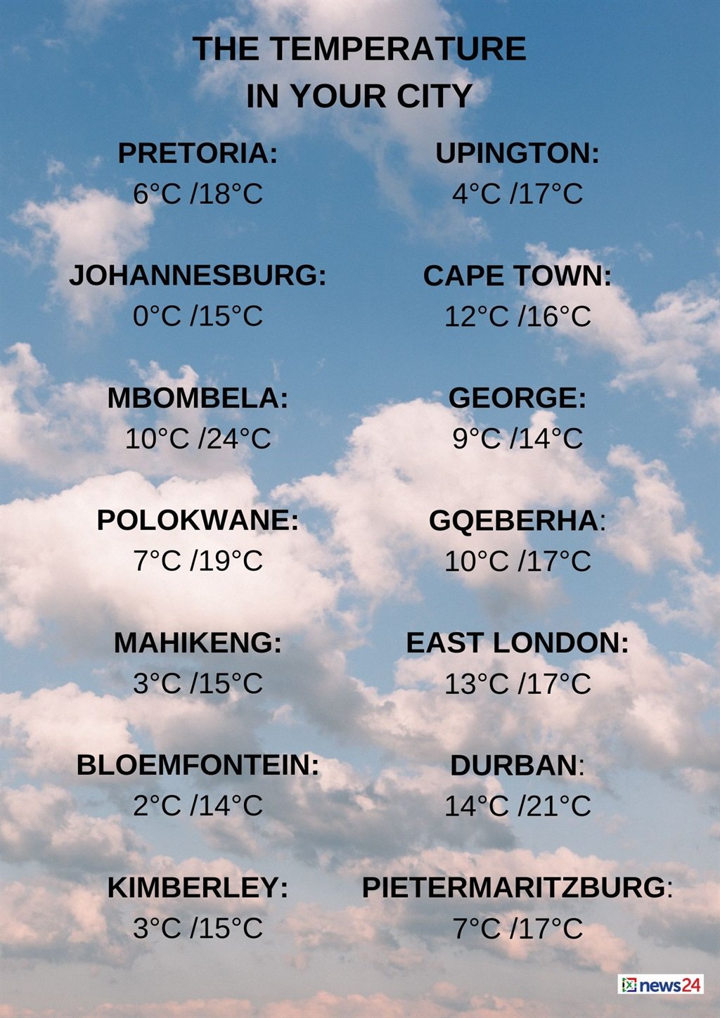
Weather in your area
Gauteng will be fine and cool to cold. The expected UVB sunburn index is very high.
Fine and cold to cool conditions are forecast for Mpumalanga, but it will be warm in the east.
Limpopo will be fine and cool to warm while North West will be fine in the east, otherwise partly cloudy, windy and cold to cool.
Morning fog patches are expected in places in Free State, otherwise partly cloudy, windy and cold to cool conditions are forecast for the province but it will be very cold in the extreme south.
Northern Cape will have morning fog patches in places in the east, otherwise it will be partly cloudy and cold to cool but very cold in the southern parts, becoming partly cloudy from the afternoon. Wind along the coast will be light and variable, becoming moderate to fresh southerly from the late afternoon.
Cloudy and cold to cool with isolated showers and rain conditions are expected in the Western Cape, except in the extreme west. The wind along the coast will be moderate northerly north of Cape Columbine, becoming moderate south-easterly to easterly from the afternoon but fresh to strong westerly to south-westerly east of Cape Agulhas becoming light and variable between Cape Agulhas and Still Bay from the afternoon spreading to the east. The expected UVB sunburn index is low.
Weather outlook for the next 3 days: temperatures decrease further tomorrow (Friday 7 June 2024) over the central, eastern and southern parts of the country while slightly increasing in the west?????? pic.twitter.com/3Asr0NecgV
— SA Weather Service (@SAWeatherServic) June 6, 2024
The western half of the Eastern Cape will be cloudy and cold with isolated showers and rain, but scattered along the coast. Light snowfalls may be possible over the northern high-lying areas. The wind along the coast will be moderate to fresh south-westerly, becoming southerly in the east in the afternoon.
The eastern half of the province will be cloudy and cold with isolated showers and rain but scattered along the coast.
Light snowfalls may be possible over the northern high-lying areas where it will be very cold. The wind along the coast will be fresh to strong south-westerly, but moderate southerly in the south, spreading to the east in the afternoon.
KwaZulu-Natal will be partly cloudy in the south at first, becoming cloudy and cold to cool with isolated showers and rain along the coast and adjacent interior. The wind along the coast will be fresh to strong north-easterly in the north at first, becoming fresh to strong south-westerly, reaching gale force in places at times. The expected UVB sunburn index is low.


Recent Comments