

Hot conditions expected across large parts of SA.
While heatwave conditions are expected to taper off on Friday in parts of the Eastern Cape and KwaZulu-Natal, persistently high temperatures will linger until Tuesday across six provinces, according to the South African Weather Service.
Impact-based warning
A Yellow Level 2 warning for severe thunderstorms remains in place over the eastern parts of the Northern Cape and southern parts of KwaZulu-Natal.
The storm is expected to bring possible strong damaging winds, heavy downpours and large amount of small hail and/or large hail (with large hail possible in places) that may result in damage to vehicles and structures.
Fire danger warning
Extremely high fire danger conditions are expected in places over the eastern parts of the Northern Cape, western parts of the Free State, eastern parts of the North West, north-eastern parts of KwaZulu-Natal and north-eastern parts of Mpumalanga as well as in places over Limpopo.
Advisory
Heatwave conditions with persistently high temperatures are expected over the eastern parts of the Eastern Cape and western parts of KwaZulu-Natal until Friday and in places over Gauteng, Limpopo, Mpumalanga, the Free State, North West and north-eastern parts of Northern Cape until Tuesday.
Outlook for Friday( 24/11/23) and Saturday (25/11/23):Very Hot to hot conditions will persist into Friday and Saturday for most of the country. Isolate to scattered showers and Thundershowers are also in the cards, except in the extreme north-eastern and western parts. pic.twitter.com/x6Ph2AZxr2
— SA Weather Service (@SAWeatherServic) November 22, 2023
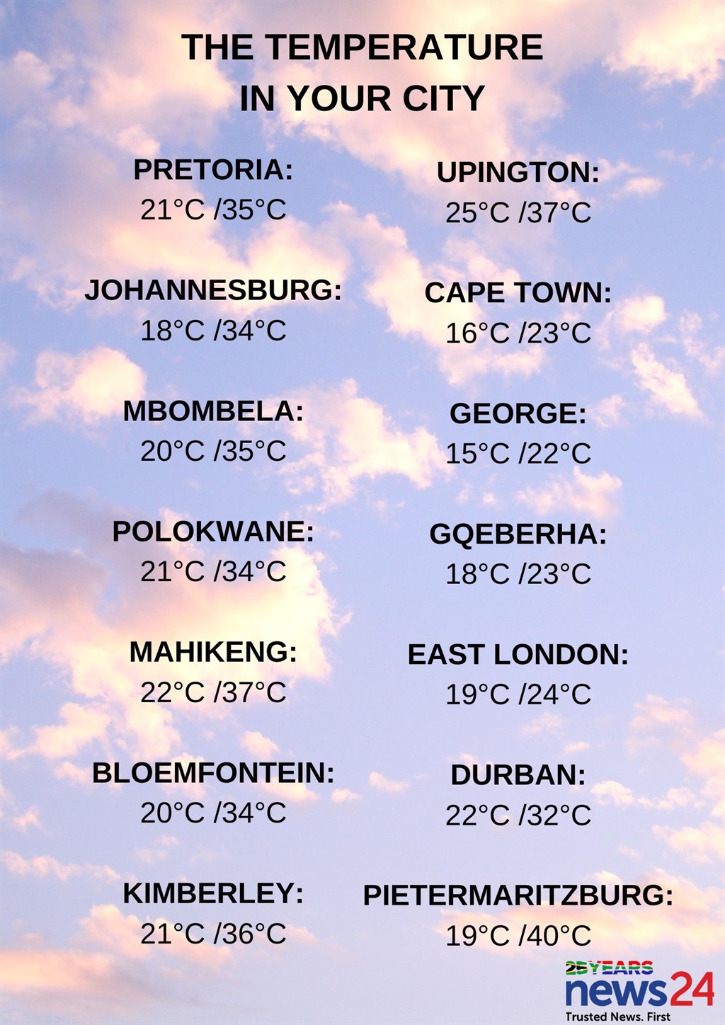
The weather in your province
Gauteng will be partly cloudy and hot, but extremely hot in the north.
The expected UVB sunburn index is extreme.
It will be fine and hot to extremely hot but warm along the escarpment of Mpumalanga, becoming partly cloudy in the afternoon with isolated evening showers and thundershowers in the extreme southern parts of the province.
Limpopo can expect fine and hot to extremely hot conditions. It will be extremely hot in places on the Lowveld.
Partly cloudy and hot to extremely hot conditions are expected in the North West with isolated showers and thundershowers in the west.
The Free State will be partly cloudy and hot to extremely hot in the north, with isolated showers and thundershowers, except in the extreme north but scattered over the southern and central parts.
It will be cool along the coast in the Northern Cape where it will be cloudy at first, otherwise partly cloudy and warm to hot conditions can be expected, along with isolated showers and thundershowers in the east where it will be extremely hot.
The wind along the coast will be moderate south-easterly, becoming fresh to strong in the afternoon.
It will be cloudy and cool along the south coast in the Western Cape with a chance of light rain in the east at first, otherwise partly cloudy and warm to hot.
The wind along the coast will be light to moderate south-westerly, becoming fresh in the south-west in the afternoon.
The expected UVB sunburn index is extreme.
Cloudy and warm to hot conditions are expected in the western half of the Eastern Cape, with isolated showers and thundershowers, but scattered along the coast.
The wind along the coast will be light to moderate southerly to south-westerly.
It will be warm along the coast in the eastern half of the province, otherwise it will be cloudy and hot to extremely hot with scattered showers and thundershowers.
The wind along the coast will be moderate to fresh south-westerly.
KwaZulu-Natal will be fine and hot to very hot, but extremely hot in places in the north, becoming partly cloudy in the afternoon with isolated showers and thundershowers, but scattered in the southern parts of the province.
The wind along the coast will be moderate to fresh north-easterly, becoming south-westerly from the south in the afternoon spreading northwards.
The expected UVB sunburn index is high.


Recent Comments